Which street do you live on? That question decides more about your weekend trail experience in Dos Vientos than most residents realize. Someone near Rancho Dos Vientos Drive can be on a mountain lion corridor within ten minutes. Someone off Wendy Drive can be back home with a leashed dog and a coffee order placed before that same ten minutes is up. Same neighborhood, same open space system, entirely different mornings.
Most people who move here learn one trailhead, usually the one at Dos Vientos Community Park, and treat it as the front door to the whole system. It is the official one. It is also the least interesting part of a much larger story.
The Open Space Is Bigger Than the Park That Everyone Uses
The Dos Vientos Open Space covers 1,216 acres in the southwest corner of the Conejo Valley, threaded with more than 41 miles of trail used by hikers, cyclists, and equestrians. That acreage does real work. It functions as a wildlife movement corridor connecting the neighborhood directly into the Santa Monica Mountains through Point Mugu State Park, which is why residents occasionally spot bobcats, mule deer, coyotes, and the reason California State Parks currently posts mountain lion caution guidance for anyone hiking the connector trails toward the state park. The habitat also shelters rarer things: Conejo buckwheat, Verity's liveforever, and Conejo dudleya are among the endangered plants found only in this stretch of coastal sage scrub and chaparral.
The community park is the primary, marked trailhead. Follow the Park View Trail to the far end of the park and you hit a decision point: cross Via Ricardo and you're on the Powerline Trail, also called the Edison Road Trail, heading toward Conejo Mountain. Or follow Via Ricardo a tenth of a mile the other direction and you're at the Vista Del Mar Trailhead, which climbs into the Conejo Hills to overlook points with views stretching to the Santa Monica Mountains, Boney Peak, Camarillo, the Topatopa Mountains, the Pacific Ocean, and the Channel Islands on a clear day. That trail eventually leads to Twin Ponds, two secluded ponds built in the 1920s for ranch irrigation that now function as a protected conservation area for migrating waterfowl, western pond turtles, and two-striped garter snakes.
That is one route. It is not the only way in.
Other Ways Into the Open Space
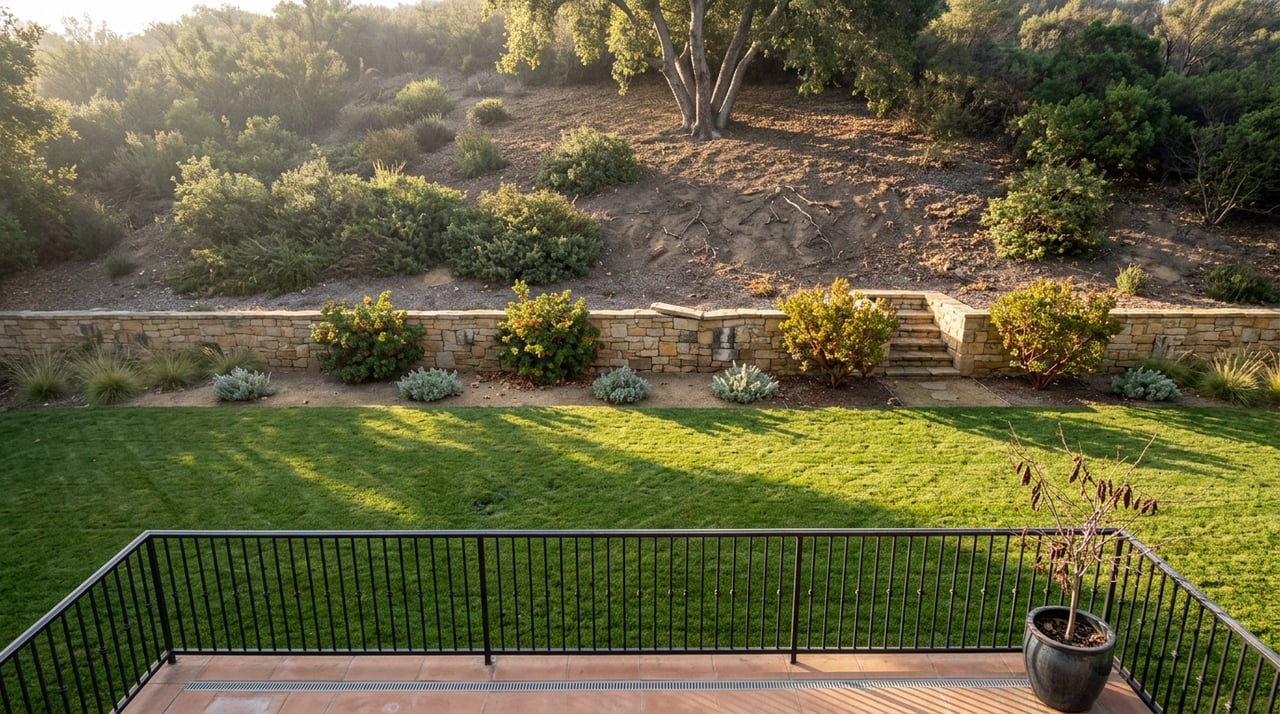
What surprises a lot of residents is how many other ways there are to walk straight from a cul-de-sac into the same open space, sometimes with no sign or parking lot, and with no mention on any map you'd find at the park entrance. A partial list, gathered from trail surveys of the area:
- The west side of Wendy Drive, between Peppermint and Felton, with an actual paved parking area
- Bear Creek Drive and Highview Street, both street-parking access points
- The west side of Reino Road, midway between Maurice Drive and Paseo De Leon, which has a large gravel lot
- The west end of Kimber Drive
- The cul-de-sac at the east end of Camino De Las Estrellas
- Via Las Brisas at Lynn Road, and again across from Calle Del Prado
- The cul-de-sac at the south end of Via Gregorio, where stairs lead directly up to the trail
- The south side of Rancho Dos Vientos Drive, just east of Via Rincon
None of these require a drive. They are simply where the neighborhood ends and the open space begins, which means two households a few streets apart can have completely different relationships with the same trail system without ever realizing it.
Why the Street You're On Changes the Hike
This matters because the trails on the other side of these access points are not interchangeable. The Wendy Trail, reached from the Wendy Drive lot, is a 1.7-mile loop with only 216 feet of elevation gain, rated easy, and dogs are welcome on a leash. It's the kind of trail you do before dinner without changing shoes.
Walk fifteen minutes farther down the same road, though, and you reach the trailhead for Wendy Trail to Waterfalls, a 3.5-mile out-and-back that climbs into Rancho Sierra Vista Satwiwa territory. Dogs are not allowed on this one at all. Keep going past that and you're on the route toward Mugu Peak, a 6.7-mile point-to-point hike with nearly 1,900 feet of elevation gain that ends in the Dos Vientos Open Space, rated a hard hike that demands real fitness and offers little shade. That one is also closed to dogs, and it puts you deep enough into Point Mugu State Park that the mountain lion advisory is not a formality.
So a household that walks out toward Reino Road and treats every trail as an extension of their front yard may be assuming leash rules and difficulty levels that only apply to the mile closest to their street. The system rewards knowing which access point leads to which kind of day, because the difference between a casual loop and a demanding backcountry route can be the same parking area, just a different fork.
Who Actually Runs This, and Why the Boundaries Keep Extending
The trail system is managed by the Conejo Open Space Conservation Agency, known locally as COSCA, a joint powers authority the City of Thousand Oaks and the Conejo Recreation and Park District created back in 1977, long before the Dos Vientos neighborhood itself existed. That's worth knowing because it explains why the open space doesn't stop at any tidy neighborhood line. Immediately to the east sits the Los Robles Trail and Open Space system, which COSCA also oversees, and it provides a continuous connection toward Westlake Village. Immediately to the south is Rancho Potrero, followed by Rancho Sierra Vista and Satwiwa under the National Park Service, and then Point Mugu State Park itself, including the more than 16,000-acre Boney Wilderness.
In practice, this means a resident who starts at a Dos Vientos cul-de-sac and keeps walking is never actually leaving a managed trail network. They are just crossing from one agency's jurisdiction into another's, usually without a sign to mark the change. The tradeoff is that some rules shift with it. Point Mugu State Park's current guidance, for instance, restricts dogs from backcountry trails and dirt roads entirely, allowing them only in day-use areas, campgrounds, and beaches, which is stricter than the leash-and-go policy on the Wendy Trail closer to the neighborhood.
Planning an Actual Weekend Around It
If you're deciding what to do with a Saturday morning rather than researching a move, the practical version of all this is simple. Know your closest access point, know what it actually connects to, and match the trail to what you're bringing with you. A leashed dog and thirty minutes points you toward the Wendy Drive loop or a short out-and-back near Bear Creek Drive. A full morning with real elevation and a camera for the ocean view points you toward Vista Del Mar out of the community park, ending at Twin Ponds if you want a destination rather than a turnaround. Anything that continues past the Wendy corridor toward Mugu Peak is a trip that deserves water, sun protection, and the mountain lion precautions the state park currently recommends: hike with someone else when possible, make noise on blind corners, and keep kids within arm's reach.
None of this changes what Dos Vientos is on paper. It changes what it's like to actually live here, which is the only version of the neighborhood that matters once you already have the keys. The open space behind your fence line is not a backdrop. It's a working trail network with its own rules, its own difficulty curve, and its own quiet corners like Twin Ponds that most people driving past on Via Ricardo will never know exist.
If you're weighing a move within Dos Vientos, whether that means trading a Wendy Drive starter for something closer to the Vista Del Mar side of the ridge, the team at McQueen & Associates has spent enough years on these streets to talk through which access points come with which properties, not just which square footage does. Reach out when you're ready to talk about what's next.
This article is general information, not legal, tax or financial advice. Consult a qualified professional about your situation.